(2nd Ed. 5/20/11)

Old landscape drawings and panoramas of the city can be mesmerizing. And they’re not just curious, interesting images of the past. Each is a one-of-a-kind, information-rich artifact. In a time when we record more data about the city in an hour than we did through
all of its first 300 years, these images tell a rare story of the city’s growth.
This post takes two old panoramas and puts them together, creating a super-panorama of the mid-19th century city. Amazingly, they are just three years apart in the 1850s, and show contiguous parts of the city.
A month ago, I was researching St. Patrick’s Cathedral and saw a panorama I’d seen many times before. It showed an industrious, bustling town from 42nd Street to the Battery. The date was 1855. Later the same day I saw another wide-angle view of the city, this one was from
Valentine’s Manuel. It depicted a more rural, uptown city, and was from 1858, just three years after the first one. Put together, the two pictures show the island from just inside Central Park all the way to the Battery.
A single building can be seen in both images, the Crystal Palace. And we should start there anyway since it will bring us to the first panorama (shown at the opening of this post).

The Crystal Palace stood where Bryant Park is today.
The monumental glass and cast-iron structure was supposedly fireproof. According to the
Encyclopedia of New York City, it “opened on 14 July 1853 as the site of the first world’s fair in the United States, an event entitled, ‘Exhibition of the Industry of All Nations,’…. [The fair] exhibited the products of agriculture and industry, and housed a collection of sculpture; it was also the first world’s fair to exhibit paintings in a picture gallery.” It's amazing to think about all the inventions
Gotham lists, they were the height of technology.
Crowds roamed the building’s halls past shimmering fountains and glaring clusters of gas lights, marveling at the miracles of the age, great and small: scales, meters, guns, lamps, safes, clocks, carriages scientific instruments, agricultural instruments, a Fresnel lighthouse lens, telegraphy and photography equipment, fire engines, ships and plans for an elevated railroad above Broadway [which would be built about 30 years later]. And machinery, everywhere machinery—machinery to pump water, sew, print, finish wood, refine sugar, set type, make ice cream, and wash gold.
Here is a Fresnel lighthouse lens (in case you were wondering)…

The building had an astonishingly short life, just 5 years, from 1853 to 1858. The purportedly fireproof building had wooden floors and burned down in 1858.
Across the street from the Crystal Palace on the north side of 42nd Street was the Latting Observatory, built about 1854. But it was also constructed of iron and wood and it would burn down in 1856!

Here’s the site today from about the same perspective, near the corner of 40th Street and 6th Avenue, Bryant Park. The WR Grace Building is about where the Latting Observatory stood.

If you don’t know the WR Grace building (Bunshaft, 1974), it’s one of the most recognizable buildings in the city. A little originality goes a long way on 42nd Street.

The Latting Observatory housed a demonstration of Elisha Otis’s new safety elevator. But it only went up two floors and guests had to climb to the top of the tower to take in the view. Which someone did to make our first image.

From 1855.… See the dome of The Crystal Palace in the foreground on 42nd Street? The Croton Aqueduct Distributing Reservoir (where the NYPL is today) stands to the left of the Crystal Palace. See the people walking along the walls of the reservoir? It was a favorite activity of Edgar Allen Poe.
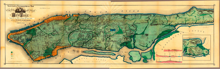
The East River and Long Island are to the left, and the Hudson River and New Jersey are to the right. What is most striking is how clearly the city was growing in a certain pattern, from the outside in. Fifth Avenue (the road coming out of the left corner) is relatively undeveloped compared to the avenues at the sides. In fact, bands of activity belted the island—ports for shipping were on water, factories and warehouses lined the shore, and shanties and tenements for the working class occupied the avenues and streets a few blocks in from the shore. The interior was left in relative quietude. And the wealthy elite, who had been moving up Fifth Avenue since the 1830s, would march though this spot on Fifth Avenue in a phalanx of brownstones in the coming decades.

In 1855, 42nd Street was used intermittently as a cattle drive. To the far right was (is) Hell’s Kitchen, already with dozens of slaughterhouses on 10th Ave. To the left (east), where the UN is today, was Dutch Hill, one of the poorest shantytowns with bottom-of-the-barrel industries like bone-boiling.
Now here's the next image, from Valentine’s Manuel. It shows a very different New York in 1858 (three years later). The view is from 63rd Street, just inside the new Central Park, and again Fifth Avenue is coming from the lower left of the picture. You can see the dome of the Crystal Palace to the right. This stretch of road will have many full and half-block mansions before it becomes home to the Plaza Hotel, Tiffany’s, Trump Tower, St. Patrick’s Cathedral, and Rockefeller Center. NBC and CBS will broadcast their national morning news programs from here.

The workers are creating Central Park, the designs for which were approved the same year in 1858. You don’t see the Latting Observatory because it burned down two years earlier, in 1856. The Crystal Palace will meet the same fate a few months after this picture was made in 1858.
The big building is St. Luke’s Hospital, between 54th and 55th Streets, which will move up to Morningside Heights in the 1890s. Across from St. Luke’s is the unfortunately named Deaf and Dumb Asylum, which was taken over by Columbia University in 1857, and will also move up to Morningside Heights in the 1890s.
Prominent in history, but not visible because it would be behind St. Luke’s, is the Colored Orphan Asylum, attacked in the horrific week-long Draft Riots of 1863 (five years after this image). The orphanage was 10 blocks behind St. Luke’s, and one block north of the Crystal Palace. It stood on Fifth Avenue between 44th and 43rd Streets, and was literally around the corner from the Crystal Palace.
Both images will be looked at in more detail in next posts.
 Valentines Manual, 1921
Here are the two images side-by-side (or top-to-bottom). A line is painted down Fifth Avenue to connect them. Together, they'll give you a sense of the city’s uptown growth like you’ve never seen before.


I was surprised at how little development there was in this part of town, so late. And remember, the lower image was three years after the image above it.
And you can almost pinpoint the uptown growth in 1858, somewhere around the mid-50s. This zoom-in floored me. Currently about the most expensive real estate on Earth, in 1858 was cow pasture. You can see the exact boundary of progress, the buildings almost seem to be eying the cows!


